Marina Road
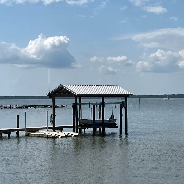
Marina Road is a marina in Orange Beach, Alabama.
Operator details
- Vessels
- Powerboat
Around here
Around Marina Road
- Buena Vista Motor Coach ResortRV park · ★ 4.63.4 mi (opens in a new tab)
- Sun Outdoors Orange BeachRV park · ★ 4.63.9 mi (opens in a new tab)
- Pandion Ridge Luxury RV ResortRV park · ★ 4.43.9 mi (opens in a new tab)
- Two Lakes RV ResortRV park · ★ 4.54.6 mi (opens in a new tab)
- Sugar Sands RV ResortRV park · ★ 4.74.6 mi (opens in a new tab)
- Gulf State Park RV ResortRV park · ★ 4.54.9 mi (opens in a new tab)
- Bon Secour National Wildlife RefugeRecreation area14.7 mi (opens in a new tab)
- Fort Barrancas Visitor CenterVisitor center16.8 mi (opens in a new tab)
- Fort Pickens Visitor CenterVisitor center16.8 mi (opens in a new tab)
- Weeks Bay National Estuarine Research ReserveRecreation area18.3 mi (opens in a new tab)
- Gulf Islands National SeashoreRecreation area20.4 mi (opens in a new tab)
Data Source: Recreation.gov · Source: USGS GNIS · Public land: USGS PAD-US
Typical water level by month
2021 to 2026
The water at Marina Road typically sits highest in September, at a median 1.10 ft, and lowest in January, at 0.23 ft. The highest water level on record for any single day is 2.55 ft, in 2021.
Show the numbers
| Month | Typical (ft) | Usual range (ft) |
|---|---|---|
| January | 0.23 | -0.13 to 0.55 |
| February | 0.29 | 0.01 to 0.63 |
| March | 0.46 | 0.19 to 0.77 |
| April | 0.71 | 0.41 to 0.89 |
| May | 0.83 | 0.62 to 1.02 |
| June | 0.91 | 0.77 to 1.13 |
| July | 0.80 | 0.65 to 0.91 |
| August | 0.86 | 0.69 to 1.14 |
| September | 1.10 | 0.93 to 1.29 |
| October | 1.07 | 0.84 to 1.31 |
| November | 0.75 | 0.47 to 1.08 |
| December | 0.56 | 0.15 to 0.85 |
Typical is the median of each month’s daily median values, and the usual range runs from the median 25th to the median 75th percentile, across about 5 years of record. Statistics published by the US Geological Survey for Intracoastal Waterway - Gulf Shores, AL. (site 02378185). Conditions on any given day can fall well outside the usual range. Check the current reading before you go.
Current conditions
Today · Sat
88Go/ 100
CloudyWaves 1.1 ft71°FRain 0%Wind 8 kt, gusts 21
Waves
0.9 ft @ 6s
Wind
4 kt
Gusts 21 kt
Water
75°F
Air
58°F
Streamflow
-732 cfs
Water level
1.69 ft
Normal (75th)
Air quality
55 Moderate
FAIRHOPE monitor, 37 km
National Weather Service
NWS issues forecasts here only during high water.
Tides
Falling
Low 0.0 ft at 5:27 AM
Predicted at Alabama Point, 1 km away.
Get a 2027 tide calendar for this stationForecast from Open-Meteo global models (NOAA & ECMWF). Flood stages and forecasts: NOAA National Weather Service. Air quality: Alabama Department of Environmental Management via EPA AirNow. Preliminary data, not verified. Tide predictions: NOAA CO-OPS, feet above mean lower low water. See full conditions →
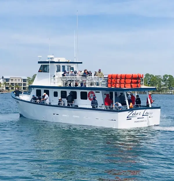
More charters in Alabama


Also nearby
Other ways to get outside within about an hour of here.
Free tools