Michael D Fishing
About
Gallery
Operator details
- Vessels
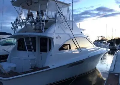
- Powerboat
Boat launches near Michael D Fishing
Loads the full map of the boat launches near this listing. We leave it off by default so the page opens fast on mobile data.
Boater reviews
What boaters are saying
- EEd McKay· 2 years ago
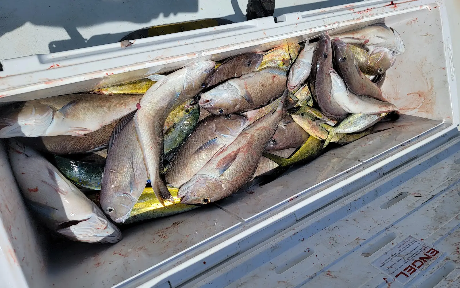
If you're serious about fishing and catching fish, book this boat. Michael D is a class act operation. I reached out to 4 operators 3 weeks before our trip to ask about availability (including a couple of neighboring boats) and Capt. Gary replied within a few hours and was the only one to do so. This trip was for a family outing with 4 kids (11-14), half day trip. The captain suggested action based fishing to keep the kids entertained, but I knew what species we wanted to target (flounder and seabass) and Capt. Gary was "all in" to making that happen. He kept in touch with all inquiries in the weeks leading up to the trip and said he was "not interested in taking us for a boat ride" and would be completely honest about the weather, action, and keeper ratio. He was 100% in every way, calling the afternoon before (after checking NOAA weather update at 4pm) to say we were a go, and the flounder were about 1 keeper per trip and seabass about 1 in 10 for fish caught. He was spot on. We met Capt. Gary and mate for the day Capt. Bruce. Both were ready to go at 7am. Perfect gentlemen and knew everything about fishing and the area as we motored out. We caught fish at every drop. Capt. Bruce kept everyone entertained and baited up, and they measured every fish so the kids knew if they had a keeper. It was truly 10 to 1, and we kept 27 seabass. We also caught 6 flounder and had 2 keepers for the effort. The Captains even offered to give us an extra 45 minutes for no additional cost because the bite was so fast and furious, and the kids were having so much fun. I can't say enough about what a positive experience this was for us and would not hesitate to recommend the "Michael D" to anyone looking to book a charter out of Indian River! Thanks Gary and Bruce for helping us make lifetime memories!
- Wwilliam longenberger· 2 years ago
Those three guys Gary, Bruce, Steve are the golden goose. Everyone was very happy. Will be back next year.
- EElizabeth Kort· a year ago
We had an amazing trip today. We caught 27 blue fish between the 8 of us. We would highly recommend.
Reviews powered by Google. Content belongs to its respective authors.
Typical flow by month
1998 to 2023
The water at Michael D Fishing typically runs highest in February, at a median 4.7 cfs, and lowest in August, at 0.7 cfs. The highest flow on record for any single day is 234 cfs, in 2013.
| Month | Typical (cfs) | Usual range (cfs) | Relative level |
|---|---|---|---|
| January | 4.2 | 2.8 to 6.1 | |
| February | 4.7 | 3.1 to 7.7 | |
| March | 4.4 | 2.6 to 6.8 | |
| April | 3.2 | 2.3 to 4.9 | |
| May | 2.1 | 1.0 to 4.1 | |
| June | 1.2 | 0.6 to 2.7 | |
| July | 0.7 | 0.3 to 1.5 | |
| August | 0.7 | 0.2 to 1.5 | |
| September | 0.7 | 0.2 to 2.3 | |
| October | 1.4 | 0.3 to 3.4 | |
| November | 2.2 | 0.5 to 5.3 | |
| December | 3.4 | 1.9 to 6.8 |
Typical is the median of each month’s daily median values, and the usual range runs from the median 25th to the median 75th percentile, across about 24 years of record. Statistics published by the US Geological Survey for Beaverdam Ditch near Millville, DE (site 01484695). Conditions on any given day can fall well outside the usual range. Check the current reading before you go.
Current conditions
Waves
6.3 ft @ 8s
Wind
23 kt
Gusts 36 kt
Water
74°F
Air
65°F
Rain chance
45%
Forecast outlook
Forecast from Open-Meteo global models (NOAA & ECMWF). See full conditions →
More charters in Delaware
Also nearby
Other ways to get outside within about an hour of here.
Free tools
Your free outdoor toolkit

Everything Map
Listings, trails, spots, clubs and public land on a single full-screen map. Switch layers on and off, then tap any point for the details.
Open Everything MapRiver Explorer
Explore named rivers from the USGS hydrography dataset. Filter by water type or whitewater class.
Open River ExplorerBoat Launches
Find public boat ramps and hand-launches on a map, with the access details that matter.
Open Boat LaunchesRoute Planner
Drop stops on a map and watch distance and drive time add up. Export a GPX or share the link.
Open Route PlannerBoat Clubs
Browse local clubs with meeting info and how to join, or start your own for free.
Open Boat ClubsLive Conditions
Real-time conditions spot by spot, pulled from public weather feeds, before you commit to the drive.
Open Live Conditions



