Safe Harbor Newport Shipyard
Safe Harbor Newport Shipyard
Marina
About
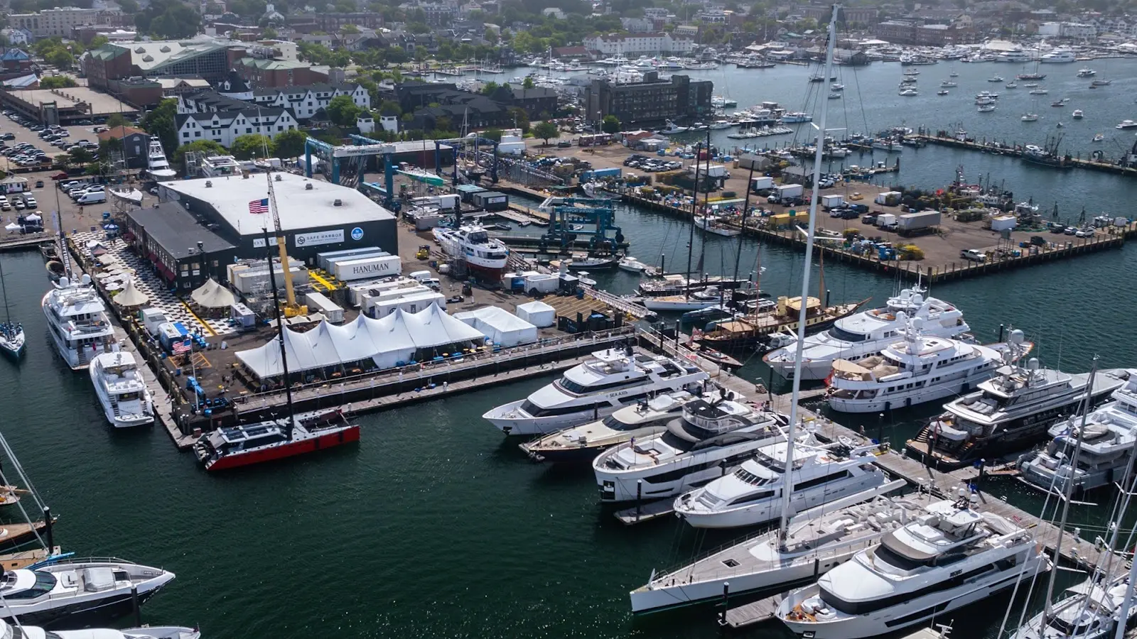
- Premier yachting destination in Newport, Rhode Island
- Deep-water transient berths for cruising and superyachts
- Full-service boatyard and refit facility
- On-site dining in a storied sailing harbor
Gallery
Operator details
- Price Range
- $$$$
- Best Season
- May–October
- Waters
- Newport Harbor / Narragansett Bay
- Vessels
- Sailboat, Powerboat
Boater reviews
4.5on Google, 95 reviews
Read the reviews on Google MapsRating from Google.
Around here
Around Safe Harbor Newport Shipyard
Loading map…
- Meadowlark Mobile Home & RV ParkRV park · ★ 4.32.6 mi (opens in a new tab)
- Second Beach Family CampgroundRV park · ★ 4.43.6 mi (opens in a new tab)
- Carr Point Recreation RV ParkRV park · ★ 4.45.5 mi (opens in a new tab)
- Newport RV ParkRV park · ★ 4.37 mi (opens in a new tab)
- Fishermen's Memorial State Park and CampgroundRV park · ★ 4.411.6 mi (opens in a new tab)
- Worden Pond Family CampgroundRV park · ★ 4.413.8 mi (opens in a new tab)
- Sachuest Point National Wildlife RefugeRecreation area4.1 mi (opens in a new tab)
- Narragansett Bay National Estuarine Research ReserveRecreation area6.9 mi (opens in a new tab)
- John H. Chafee National Wildlife RefugeRecreation area8.1 mi (opens in a new tab)
- Trustom Pond National Wildlife RefugeRecreation area15.5 mi (opens in a new tab)
- Ninigret National Wildlife RefugeRecreation area20.7 mi (opens in a new tab)
- Block Island National Wildlife RefugeRecreation area22.6 mi (opens in a new tab)
Data Source: Recreation.gov · Source: USGS GNIS · Public land: USGS PAD-US
Current conditions
Today · Fri
42Maybe/ 100
4.9 ft waves · 100% chance of rain
RainWaves 5.2 ft64°FRain 100%Wind 19 kt, gusts 27
Waves
4.9 ft @ 6s
Wind
16 kt
Gusts 27 kt
Water
60°F
Air
62°F
Air quality
38 Good
Narragansett monitor, 8 km
Tides
Falling
Low 0.2 ft at 11:11 PM
Predicted at NEWPORT, 2 km away.
Get a 2027 tide calendar for this stationForecast from Open-Meteo global models (NOAA & ECMWF). Air quality: Rhode Island Dept. of Environmental Management via EPA AirNow. Preliminary data, not verified. Tide predictions: NOAA CO-OPS, feet above mean lower low water. See full conditions →
More charters in Rhode Island

Also nearby
Other ways to get outside within about an hour of here.
Free tools