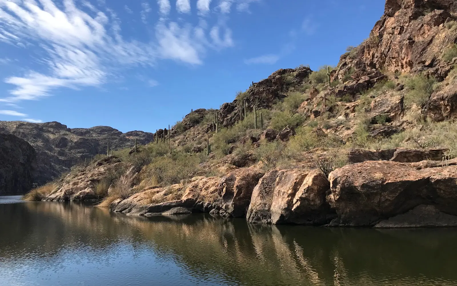
Saguaro Lake Marina
About
Gallery
Operator details
- Vessels
- Powerboat
Boat launches near Saguaro Lake Marina
Loads the full map of the boat launches near this listing. We leave it off by default so the page opens fast on mobile data.
Boater reviews
What boaters are saying
- EElena Rodriguez· a month ago
I had a wonderful day here. The marina is small and has a restaurant that is hit or miss as to whether it’s opened or closed as it frequently changes ownership. Staff at the restaurant were kind and polite and our boat ride was wonderful. there was also live entertainment on Board by the local singer named Eric originally from New York. Bottled cocktails and beer are available on board.
- KKevin Davis· 5 months ago
Beautiful spot for a day trip just a short distance from the Phoenix/Mesa area. We took the Saguaro Lake tour aboard the Desert Belle. We had done the same thing at Canyon Lake aboard the Dolly Steamboat on a prior visit to Mesa, and thought it would be fun to check out Saguaro Lake this time. We had been here before to Kajak, and loved the lake and wanted to see more of it. The boat cruise was was fun, but if I had to choose, Dolly Steamboat was a much nicer experience. With that said, if you plan on doing both anyway, do this one first and then Dolly, so it is an upgrade and not a downgrade. Both are worthwhile. The Desert Belle utilizes folding chairs in rows for your comfort, and Dolly has tables and chairs so you can face each other. Just a more comfortable experience. Either way, get there way early (an hour or so) to have a better choice of seating as it is first come, first served.
- TTammy Albertsman· 3 months ago
Was going to ride the tour boat but went to marina restaurant first to sit have lunch and maybe a drink but found out they don't open till almost noon, big bummer cause we wanted to enjoy the morning with breakfast or brunch and get on our tour you don't get food before don't have enough time, so by the time the tourwas over it's in between dinner and we had to get home so no breakfast, tour was during lunch so didn't get to go to restaurant and to late when we got back., so i don't know how the restaurant was , but all other marinas i know open for breakfast so I will go there next time, but if your looking for just a boat tour captain Dan and staff on the boat were great .
- Kkellyjo· 4 months ago
A friend recommended this activity for when we had family in town and it was loved by all (ages 5 to 65). The staff were friendly and informative. We had perfect weather and the snack choices were much appreciated. Boat was clean and comfortable.
Reviews powered by Google. Content belongs to its respective authors.
Typical flow by month
1941 to 2026
The water at Saguaro Lake Marina typically runs highest in July, at a median 1,330 cfs, and lowest in November, at 9.4 cfs. The highest flow on record for any single day is 54,000 cfs, in 1979.
| Month | Typical (cfs) | Usual range (cfs) | Relative level |
|---|---|---|---|
| January | 10 | 5.0 to 188 | |
| February | 12 | 5.5 to 517 | |
| March | 423 | 9.3 to 1,070 | |
| April | 820 | 404 to 1,240 | |
| May | 991 | 599 to 1,370 | |
| June | 1,275 | 981 to 1,690 | |
| July | 1,330 | 985 to 1,670 | |
| August | 1,210 | 869 to 1,660 | |
| September | 1,170 | 894 to 1,430 | |
| October | 365 | 11 to 806 | |
| November | 9.4 | 6.1 to 254 | |
| December | 10 | 6.5 to 248 |
Typical is the median of each month’s daily median values, and the usual range runs from the median 25th to the median 75th percentile, across about 82 years of record. Statistics published by the US Geological Survey for Salt River below Stewart Mountain Dam, AZ (site 09502000). Conditions on any given day can fall well outside the usual range. Check the current reading before you go.
Current conditions
Streamflow
925 cfs
Normal (46th)
Water level
4.52 ft
High today
97°F
Wind
11 kt
Gusts 19 kt
Rain chance
15%
Week ahead
Forecast from Open-Meteo global models (NOAA & ECMWF). See full conditions →
More charters in Arizona
Also nearby
Other ways to get outside within about an hour of here.
Free tools
Your free outdoor toolkit

Everything Map
Listings, trails, spots, clubs and public land on a single full-screen map. Switch layers on and off, then tap any point for the details.
Open Everything MapRiver Explorer
Explore named rivers from the USGS hydrography dataset. Filter by water type or whitewater class.
Open River ExplorerBoat Launches
Find public boat ramps and hand-launches on a map, with the access details that matter.
Open Boat LaunchesRoute Planner
Drop stops on a map and watch distance and drive time add up. Export a GPX or share the link.
Open Route PlannerBoat Clubs
Browse local clubs with meeting info and how to join, or start your own for free.
Open Boat ClubsLive Conditions
Real-time conditions spot by spot, pulled from public weather feeds, before you commit to the drive.
Open Live Conditions



