The Florida Keys are one of North America's most iconic cruising corridors, stretching about 113 miles from the mainland to Key West. The run is also one of the most technically demanding passages you'll attempt: shallow waters, narrow channels, strong currents, and low bridges require respect and precise navigation. For cruisers making this passage, success depends on knowing where you can anchor safely, which marinas have reliable facilities, and how to time your movement around tidal flows and bridge schedules. This guide distills the practical knowledge of cruisers and operators who've made the journey hundreds of times, offering the specifics you need to move confidently through the Keys without running aground.
Navigating the Shallow Waters and Bridge Clearances
The Intracoastal Waterway threads through the center of the Keys, sitting at the confluence of the Gulf of Mexico and the Atlantic. Depths are unpredictable, you can find 12 feet in one stretch and 2 feet in the next. Most of the ICW through the Keys runs 4–6 feet at mean low water, which means draft is a critical factor. Cruising sailboats drawing more than 7 feet will face real grounding risk and may need to use the deeper Atlantic route outside the keys entirely.
The fixed bridges present their own challenge. Several major spans, including the Seven Mile Bridge (65 feet clearance) and most Marathon bridges, are manageable for typical cruising vessels. But don't assume every bridge is high: the Bahia Honda Channel bridge clears only about 20 feet, and older middle-Keys crossings (such as Channel Two) drop as low as 10–11 feet. You need a precise measurement of your air draft including all antennas, wind generators, and radar domes before you leave the dock. Drawbridges in Key West and Marathon operate on published schedules, with some opening on demand and others on hourly cycles.
Real-time chart plotting is non-negotiable here. Carry current NOAA charts and use them actively at the helm rather than relying on memory. The Florida Keys have centuries of wrecks in the shallow areas; the obvious channel isn't always the safest path. Many cruisers integrate chartplotting systems that overlay tide and depth information in real time, which makes a meaningful difference in narrow sections. Update your charts at the beginning of each season, as conditions shift seasonally.
Best Anchorages from Key Largo to Marathon
Anchorages in the Keys split into two categories: protected Gulf-side spots and more exposed Atlantic options. The Gulf side typically offers better weather protection and more reliable holding ground, though it's crowded in winter. The Atlantic side has more elbow room but less shelter in rough conditions.
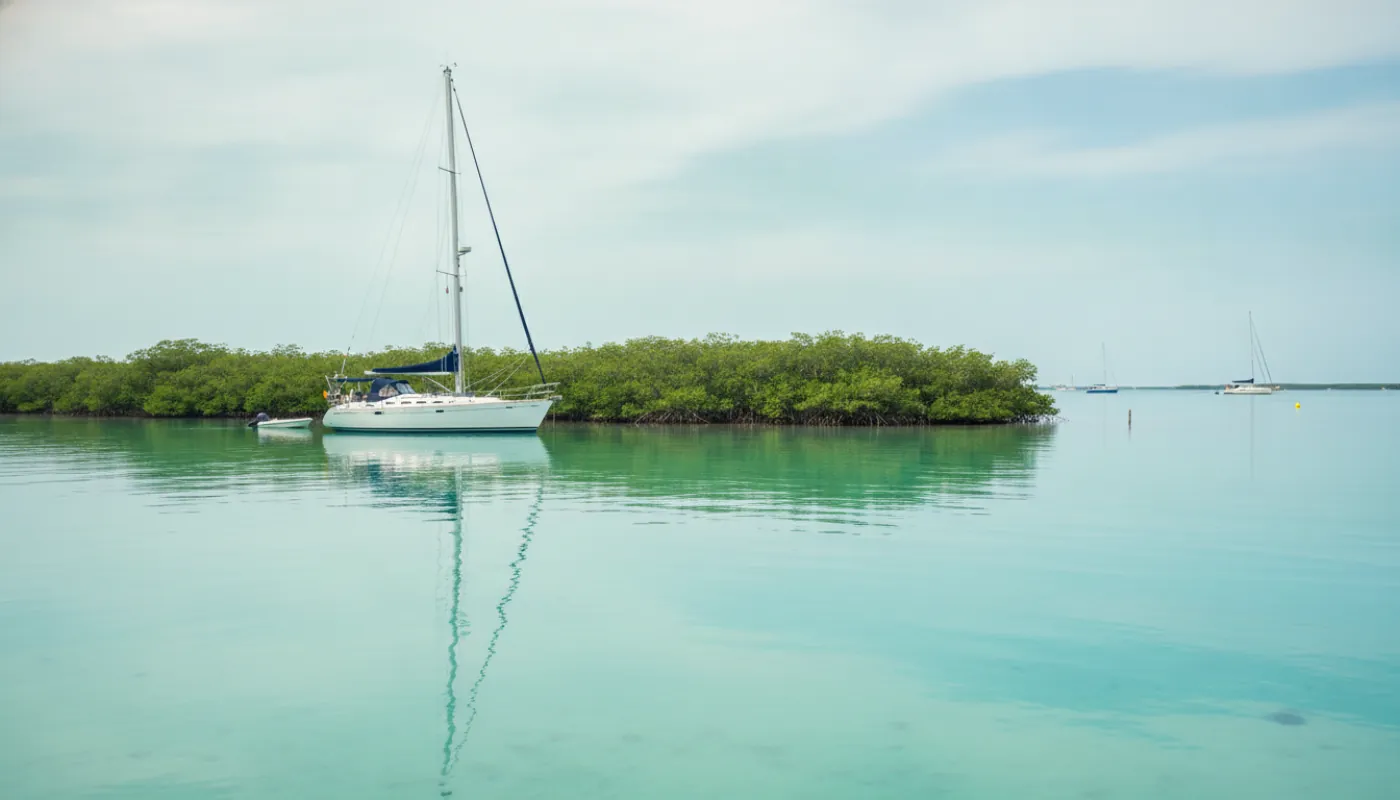
From Key Largo southward, Buttonwood Sound and Rodriguez Key are consistent Gulf-side options with holding in 4–6 feet of sand. Visibility is limited, but protection is solid in most weather patterns. Further south around Marathon, Boot Key Harbor is the primary cruiser hub, but it's a managed City of Marathon mooring field (roughly 226 moorings), not an open anchorage. Arriving cruisers pick up a City mooring; when the field is full you go on a waiting list and anchor only in the designated outside anchorages, staying at least 100 feet clear of the marked mooring-field boundary as Florida law requires. Check mooring availability ahead in winter, when the field fills fast.
Sombrero Reef, marked by Sombrero Key Light roughly 4 nm south of Marathon on the Atlantic side, is a popular daytime snorkel and dive stop, not an overnight anchorage. It sits inside a Florida Keys National Marine Sanctuary Preservation Area where anchoring is prohibited; instead, you tie off to one of the roughly 11 public mooring buoys on the south side of the reef and explore the spur-and-groove coral. Treat it as a calm-weather day excursion from Boot Key Harbor, and pick up your overnight anchorage back in the harbor rather than offshore at the reef.
South of Marathon, your options contract sharply. Bahia Honda State Park, near the bridge of the same name, has designated anchoring areas with good holding but limited space and strict regulations. Day use is permitted; overnight anchoring is restricted. Beyond Bahia Honda, most cruisers push directly to Key West, which has several holding areas on both the Gulf and Atlantic sides. Fair warning: holding can be inconsistent, and winter crowding is severe.
Marina Options and Slip Selection
For cruisers looking to anchor out less frequently, marinas exist throughout the Keys, though they carry premium pricing and winter availability is tight. Selection strategy depends on your draft and budget tolerance. Most marinas maintain slips in the 4–6 foot depth range, accommodating the majority of cruising sailboats. Deeper-draft vessels may find choices limited.
Marathon offers the highest concentration of marina infrastructure and is typically your best option for a week-long slip. Facilities include fuel, water, reliable internet, and laundry, critical services if you're timing a longer landfall. Expect to pay roughly $3–$6 per foot per night plus amenities fees during peak season (November through April). Most marinas require reservations six months in advance for winter stays. Call ahead, don't assume availability.
Key West marinas cluster around the harbor entrance and downtown docking areas. Availability is even tighter than Marathon, and rates reflect that scarcity. The payoff is immediate walkable access to restaurants, provisioning, and marine services. If you're planning a 2–3 day stop in Key West, a slip is worth the premium for security and convenience.
Smaller settlements between Key Largo and Marathon (Islamorada, Big Pine Key) have essentially no commercial transient marina infrastructure. Private residential marinas occasionally rent transient slips, but this requires advance connections or local knowledge. If you're targeting anything smaller than Marathon or Key West, plan well ahead and make phone calls early.
Seasonal Considerations and Weather Windows
The Keys have a pronounced seasonal cruising window, driven by weather patterns and operating capacity. Winter (November through April) is peak cruising season and also the most crowded. Water temperatures typically hold in the low-to-mid 70s (dipping to the upper 60s in a cold snap), and hurricane risk is near zero. Winter also brings strong northerly winds, 15–25 knots are common, that can kick up the Gulf and make exposed anchorages uncomfortable.
Spring and early fall offer lighter winds and thinner crowds, but hurricane season (June through November) introduces genuine risk. Most experienced cruisers avoid the Keys entirely during peak hurricane months (August through October), when tropical systems move through the region regularly. If you're caught in the Keys during a tropical storm watch, your options evaporate, marinas book solid within hours, and anchoring in hurricane conditions is untenable. The safest strategy is to time your passage to avoid hurricane season or exit the Keys to protected waters further north.
Summer brings gentler winds and fewer cruisers, but the heat and humidity are intense, and afternoon thunderstorms are frequent. Navigation is often clearer due to improved visibility, but the weather window for safe passage is narrow.
Tidal currents here run strong, up to 2 knots in narrow ICW sections. Plan your departures to catch favorable current flows, especially if you're running a modest outboard or under sail alone. Slack water windows typically last 30–45 minutes, so departure timing directly impacts your fuel consumption and arrival time.
Essential Charts and Navigation Resources
No cruising passage in North America demands as much charting discipline as the Florida Keys. Your starting point is NOAA charts specific to the region, the waterproof, detailed sheets that focus on the ICW and the Keys themselves. Digital chartplotting systems from established marine electronics manufacturers are valuable, but they're never a replacement for paper charts. Electronics fail, batteries drain, and software becomes outdated. Carry both formats.
Beyond official charts, cruising guides dedicated to the Keys are essential tools. Published cruising guides include waypoint data, precise bridge clearances, current marina contact information, and anchorage details (depth, holding composition, protection ratings) accumulated by decades of cruiser experience. These cost little and repay their investment many times over.
Current conditions shift constantly. NOAA's tide and current predictions are available online and through marine apps, some chartplotting systems integrate this data in real time, allowing you to see predicted current vectors overlaid on your chart. This capability makes a substantial difference in narrow channels.
Before you depart, reach out to other cruisers who've recently made the passage. Active VHF nets operate daily on Channel 16 throughout the Keys, providing real-time reports on bridge schedules, anchorage conditions, and recent shoaling or changes. Bridge operators and marina staff are reliable sources for current information, a quick VHF call often saves hours of uncertainty. The local knowledge flowing through cruiser networks is invaluable and free.