The roughly 430-nautical-mile (about 500 statute miles) passage from San Diego to San Francisco is one of North America's most iconic coastlines, yet it demands serious planning. Unlike sheltered bays or protected waters, the California coast presents every cruiser with a fundamental strategic choice: hug the shoreline through coves and bays, or break offshore where deeper water and steadier winds offer a different set of advantages. That choice ripples through your passage plan, your crew preparation, your timing, and your weather strategy. This isn't a "best route" article, there isn't one. Instead, this is how to think through what inshore and offshore routes give you, when each makes operational sense, and how to navigate either safely with full command of the conditions and waypoints ahead.
Offshore vs. Inshore: Key Differences
The inshore route keeps you within visual distance of land, threading through bays and anchoring in the lee of headlands. San Diego Bay itself offers protected water and numerous anchorages; up the coast, you'll find holding in Mission Bay and along the kelp beds off Orange County. Catalina Island's lee side, Two Harbors and Avalon, provides a natural waypoint where crews can resupply and overnight safely, though even the San Diego-to-Catalina hop runs roughly 63–76 nm, so several legs are genuine open-water passages rather than short coastal hops. The journey becomes a series of legs that you can break to overnight in protected water, giving you flexibility to manage the trip in lower-stress stages. Crew comfort is higher; the ride is smoother. You can adjust your schedule day-to-day based on conditions, which matters for charter operations that can't absorb multi-day weather delays.
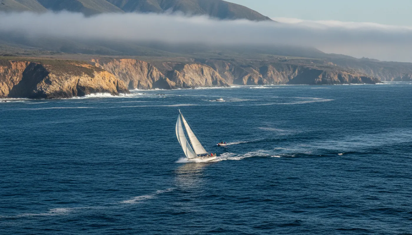
The offshore route is operationally distinct. You head out to 20-30 miles or beyond before pushing north, trading the chop of shallow water for cleaner swells and more predictable wind patterns. The California Current flows south; offshore, that current moves more steadily and your boat speed becomes more consistent. There's less traffic, fewer navigational hazards, and if conditions align, the passage becomes genuinely efficient: fewer course changes, longer sustainable boat speeds, and you're not fighting an afternoon thermal breeze that builds the chop. But you're committed: once offshore, turnarounds take hours, and you need solid crew, good weather judgment, and navigational confidence. Fog at night becomes a serious concern, particularly in early summer. Operational difficulty is higher, but the sailing itself, when conditions cooperate, feels more authentic.
Seasonal Cruising Windows and Weather Patterns
May through September is the high season for West Coast cruising, and deservedly so. Summer brings lighter, more predictable winds, typically 8-15 knots from the northwest by late morning, dying out in evening. Fog is constant, especially in June and early July, but it usually burns off by midday on inshore routes. Sea state calms as the season progresses into August. Don't be lulled about the water, though: this coast stays cold year-round, roughly the mid-50s to low 60s even in late summer, and colder still north of Point Conception where upwelling dominates. Cold-water shock and hypothermia remain a primary man-overboard threat the whole way, not a reduced one. Dress and rig for it regardless of season. This is when charter operators run the most departures and when single-handed sailors feel most confident on the passage. A sailboat making reasonable progress can complete the route in 3-5 days; power cruisers often do it in 2-3.
Spring and fall bring rougher conditions but often cleaner sailing windows for committed operators. April through May sees stronger pressure systems; winds can gust into the 20s, and that afternoon chop builds fast on inshore routes. Conversely, the offshore route in fall often delivers the best sailing on the entire coast: steadier winds, less fog, better visibility, and fewer cruisers competing for anchorage space. Winter is marginal for any operation beyond single-dedicated sailors. Storm systems move through regularly, pressure drops quickly, and a single bad forecast can ground you for days. If you're running a school or charter program, winter passage seasons mean losing charter days to cancellations. The few operators who do run in winter typically commit to the offshore route to avoid the worst coastal pressure systems, but it's specialist work.
Anchorages and Waypoints Along the Route
For the inshore route, your anchor work will be constant. Start in San Diego Bay, which offers multiple anchorages with sand and mud holding. Push to Mission Bay or up the coast as conditions allow. Note that San Clemente Island is a Navy-controlled island roughly 68 nm offshore, not an inshore coastal waypoint, so it isn't part of a shoreline-hugging route. Catalina Island's lee side is the indispensable waypoint, Two Harbors provides good holding and visitor anchorages, while Avalon offers mooring buoys and provisioning. From Catalina, push to the Channel Islands (Anacapa and Santa Cruz offer anchorages but demand attention to swell direction), then to Morro Bay, which provides the first truly protected large anchorage north of Catalina. Cayucos and Cambria offer secondary options with reliable sand holding. San Simeon Bay, just north, is the last real shelter on the route, and even it is exposed, offering protection only from the northwest. Past San Simeon you face a long open run of roughly 70 nm up the Big Sur coast with no viable overnight anchorage until you reach Monterey. That sustained lack of shelter is the defining hazard of the leg: you must time your weather window to make the entire passage in one push, because there is nowhere safe to duck in if conditions deteriorate. Press through to Monterey Bay or the Carmel anchorage area, where you'll find adequate holding in 30-40 feet.
The offshore route simplifies logistics but demands better weather judgment. You're less focused on anchoring and more on open-water passaging. If you must stop, Monterey Bay and Carmel are reliable. Many offshore-route sailors press straight through, it's operationally possible to leave San Diego at dawn and reach the San Francisco Bay approaches by evening the following day, depending on wind and sea state. Intermediate fuel and water stops are limited, which is why many power cruisers prefer the inshore route despite longer transit time. Key navigation waypoints for the offshore route include a position 30+ miles west of Point Conception (the major pressure concentration on the coast) and then a northeast approach into Monterey Bay. Plan your position fixes every few hours and cross-check GPS against traditional bearings, electronics fail, and your ability to revert to paper charts and compass is a basic safety requirement.
Navigation and Safety Considerations
Point Conception, roughly midway between San Diego and San Francisco, is where the California coast bends from running north-south to east-west. That bend concentrates pressure systems and creates genuine operational hazard. Inshore, you're threading through the Santa Maria basin with shallower water and commercial traffic, workload increases and your reaction time to deteriorating conditions shrinks. Offshore, you have maneuvering room, but the swell becomes noticeably larger. Every experienced California cruiser has an opinion about Conception; the consensus is neither complacency nor panic, but clear-eyed assessment of current conditions. Check marine forecasts specifically for pressure trends 12-24 hours ahead. A rising barometer usually means stable or improving conditions. A falling barometer signals an incoming system; if you're inshore, you'll feel the effects sooner and have fewer bailout options.
Current navigation requires GPS, but paper charts and compass work remain essential insurance. The California coast has kelp forests, shoals, and oil rig fields (particularly offshore of Ventura and Santa Barbara) that demand chart work. Fog means radar or AIS becomes a genuine safety tool, commercial traffic on the West Coast follows defined shipping lanes, and a sailboat announcing nothing but GPS presence is at risk. VHF radio discipline matters; monitor Channel 16 and use your call sign. If you're running a teaching program or charter operation, consider a personal locator beacon and a satellite communicator, particularly for offshore routes where Coast Guard rescue assets are hours away. Crew experience is your final control: if your team has never been genuinely fogbound or seen a real swell, start inshore, build your passage confidence over multiple seasons, and let real experience guide your decision on when offshore cruising becomes operationally appropriate.